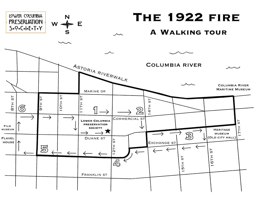
The following directions are for a suggested walking-tour path. Be careful at crosswalks and always look both ways. Several of Astoria's streets are one directional but occasionally visitors unfamiliar with the area take wrong turns.
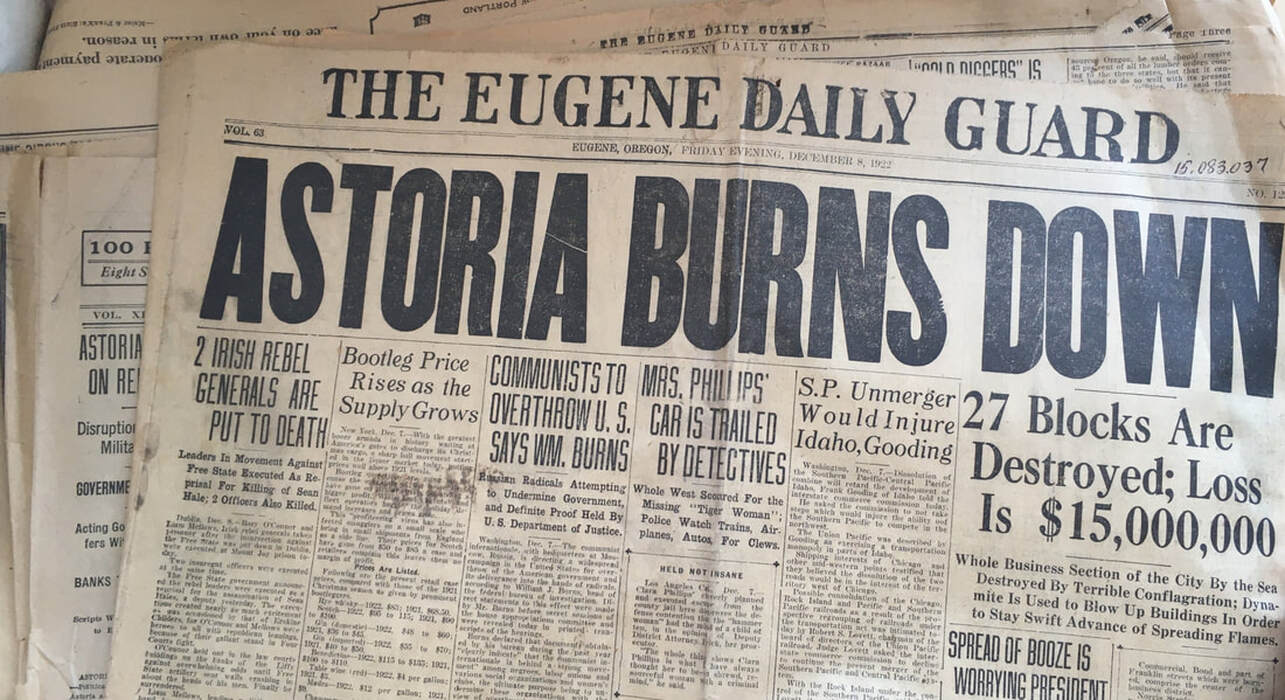
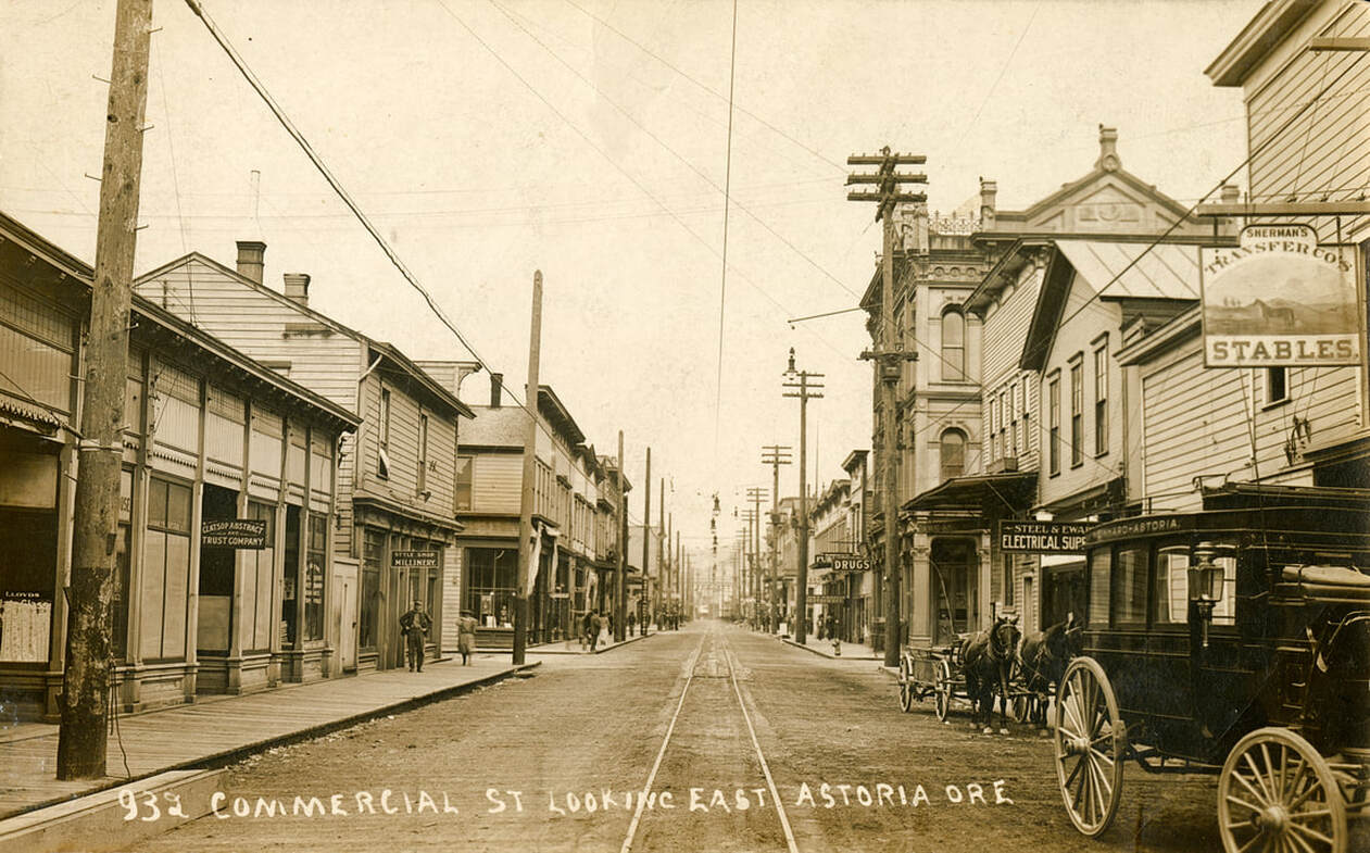
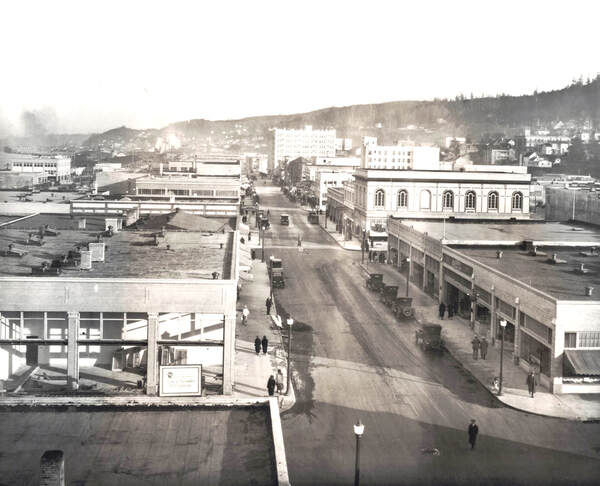
In the wee early hours of December 8, 1922, around 2 o’clock in the morning, a fire began in the center of downtown lighting up the city of Astoria as if it were day and big enough to see as far as Seaside. This fire would go on for 11 and a half hours, destroying the majority of Astoria’s business district. At this point in Astoria’s history, the town looked pretty different than it does today. Astoria was at its height of prosperity using its surrounding natural resources of fish and timber to benefit its booming economy. Canneries, mills, and boarding houses lined the piers over the water with hotels, saloons, drugstores, hardware stores, furniture shops, and more filling up downtown with hustle and bustle flanking the tracks of the trolley that ran up and down Commercial Street giving rides to passengers going to and fro about town. In some parts of downtown, the tide stretched all the way to Franklin Street and many of the ornate buildings along Commercial Street were built from spruce sitting atop wooden pilings over the tide flats marking the edge of the Columbia River. This design made it possible to keep houses up the hill on solid ground where they were incidentally protected from the hazardous and vulnerable areas supported by mostly wood frames. The photo below was taken at 9th and Commercial before the fire burned it all down. Notice the ornate building on the right side. That is the original Odd Fellows building. The Odd Fellows building that stands today was built on the foundation of the one seen here. This portion of downtown was built over the tide flats.
“Picture — if you wish to visualize this fire — a city built on a hillside. At the bottom is a flat section which was the business district. Next comes the railroad track and across the tracks are the docks, warehouses and wholesale houses. The section on which the business district was erected was too low, so it was filled with dirt from the hills, and the buildings set upon this fill. The streets, however were not filled in. The main street through the district — Commercial street — was a long viaduct, with an open space under it through which the wind was at liberty to whistle. And the side streets running off from it also were viaducts.”
-The Oregon Daily Journal, Portland Oregon, December 9, 1922.
This tour will take you back in time to 1922 when Astoria lost so much but put it all back together with perseverance and two simple words: Let’s Go.
|
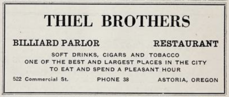
We will begin at the number 1 on the map: the Point of Origin on Commercial St. between 11th and 12th Streets. On the north side of the street you would have seen Thiel Brother’s Restaurant and Billiard Parlor. A few buildings to the right sat Bee Hive Department Store. According to multiple newspapers, the fire started at 2:10 a.m. in the basement of Thiel Bros. Shortly after, the fire jumped to the Bee Hive Department store and within thirty minutes, devoured the entire block. No one knows for sure how exactly the fire started. Speculation includes a kitchen related incident, cigarettes, or other foul play. If you’ve ever built a campfire, then you know that the easiest way to start a fire is to build a frame out of kindling allowing ample oxygen to flow beneath it. This is more or less how downtown was built which eventually made a pathway for the fire to burn and spread both above and beneath the streets. Upon the sound of the alarm at 2:12 a.m., some individuals began banging on doors of slumbering people to get them out of the buildings, others attempted to save uninsured merchandise from various shops by throwing stuff out the windows and into the streets. |
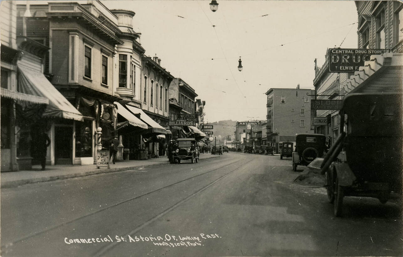
If you’ve been on the present-day Astoria Riverwalk where some of our local businesses operate on piers, then you have experienced what the business district of Astoria was like in the 1920s. When the town was originally built, it was easier to construct over the tide flats than into the forested hills, hence giving Astoria its nickname of being the ‘Venice of the West.’ You could quite literally take a small boat under and through parts of downtown or swim in the water underneath some of the businesses. Imagine standing here on Commercial St. in 1922. Many of the buildings and streets were constructed out of spruce timber from the nearby forests. Trolley tracks ran down the center of the street, which in those days was much narrower since the street didn’t need to accommodate all of the vehicle traffic that it does today. Later on our walk, we’ll talk more about the width of the streets and how that changed in the rebuild. Let’s continue on the north side of the street and head east down Commercial St. to take a look at a building that lived to tell the fiery tale. This photo is taken years before the fire from 12th and Commercial Streets.
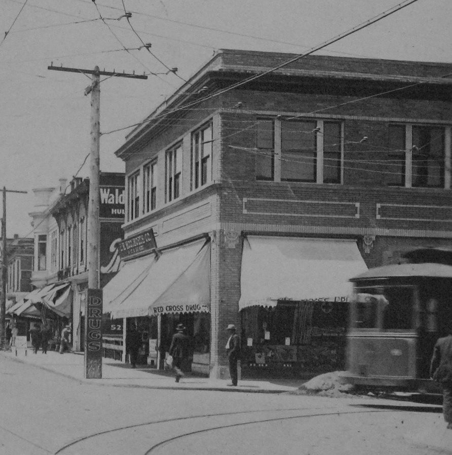
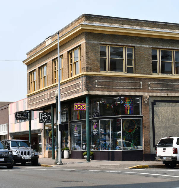
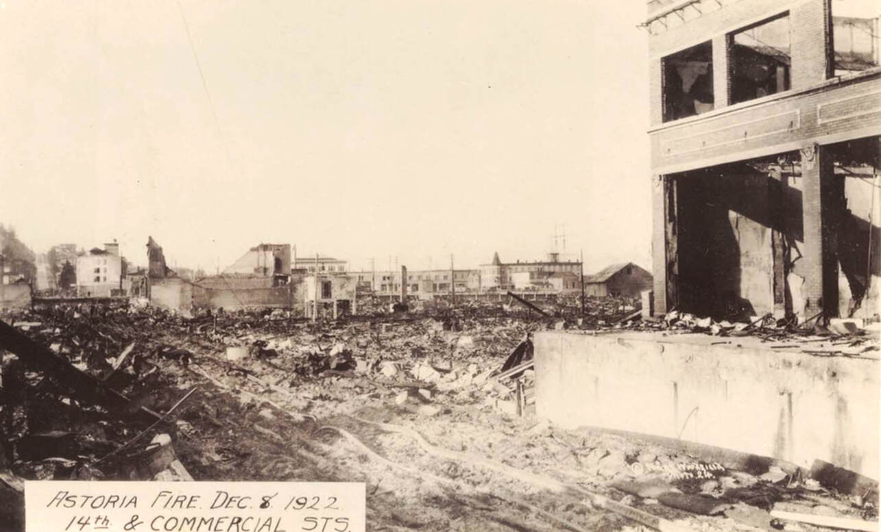
When you reach 14th street, we will have arrived at the Young Building, our second tour stop. In 1922, this corner building operated as the Astoria Drug Company. If you look closely at the photo, you will notice a small sign on the left side of the street labeled 'Drugs.' That is the Young Building. This brick building was one of two Commercial Street buildings that survived the great fire. While much of the interior was ruined, its brick and mortar design protected it from total destruction. You’ll notice that the store front is not completely aligned with its second story. The bottom half has been recessed with the top supported by metal columns. It didn’t always look this way. This building was originally designed with a flat facade. When Astoria was rebuilt between 1923 and 1925, the plan was to widen the street to make room for the ever growing automobile industry. Instead of knocking the Young Building down, they simply cut out part of the first story store front to align it with its new neighboring buildings, making both the side walks and the streets wider. In many of the photographs that were taken days after the fire, you will see the Young Building still standing above the flattened downtown. This photo was taken on 14th looking south toward Commercial. You can see the Young Building on the right with its windows blown out leaving its walls remaining intact. Notice the twisted metal of the streetcar rails at the bottom of the photo. The fire was so hot, that it melted the steel.
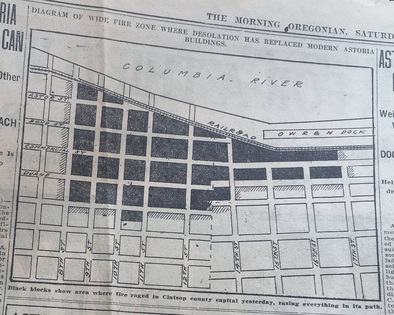
Our map shows a rough outline of the fire’s reach. So far, we have been within the radius of the fire. Let’s walk along its edge to see the path it took toward Astoria’s St. Mary’s Hospital and City Hall. At the light, take a right on 14th and cross the street.
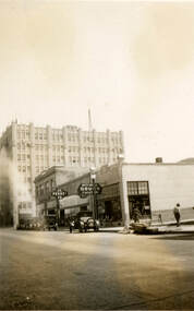 Courtesy of Clatsop County Historical Society
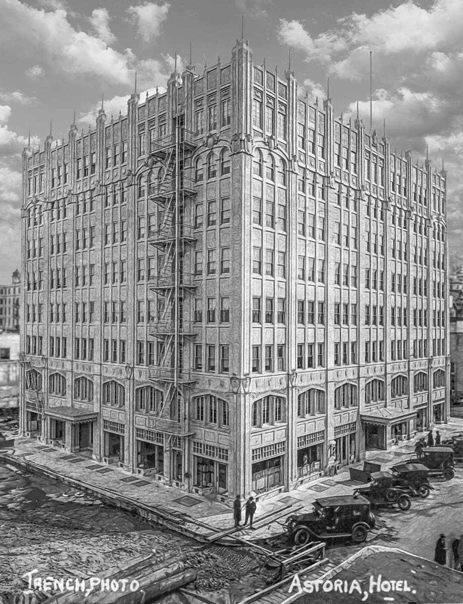
On this block, you will see the giant white John Jacob Astor Hotel. Originally known as the Astor Hotel, this building narrowly missed the fire due to good timing. A permit to construct the hotel was issued in November of 1922 and only the foundation had been installed. Originally designed to be five stories, this historic hotel was built eight stories high and is one of the tallest structures on the Oregon coast. Hotel Astoria’s first guests checked in on January 1st, 1924. That February, a grand banquet and celebration with dinner and dancing took place in the ballroom as the mighty building stood above the ruins. This event conjured hope from citizens and invited out-of-towners to celebrate Astoria’s rise from the Ashes.
Continue up toward Duane St. then turn left. Amid the heavy clouds of smoke, one could hear oil tanks blowing up, ammunition exploding at the Astoria Hardware Company, and dynamite being used as an attempt to stop the path of conflagration.
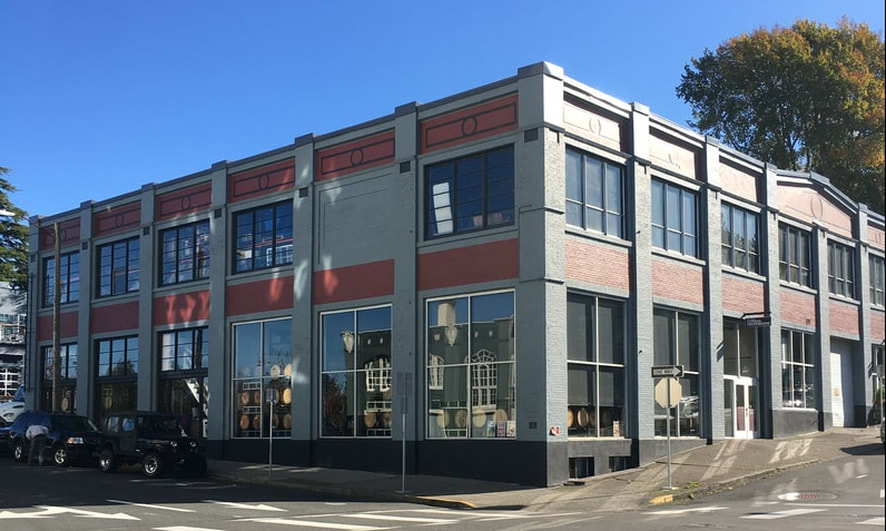
Where Fort George Brewery stands today was Lovell Auto Company in 1922. This building was set to be blown up with dynamite to stop the fire path before it reached St. Mary’s Hospital, however, the building owner, Sherman Lovell, refused to let the fire department do its work and stood atop the building’s roof making his own attempt to save his building. Just weeks later, the Blue Mouse theatre opened its doors on the second floor of the Lovell garage showing Christmas movies and packing the house with hundreds of people.
|
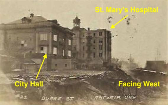
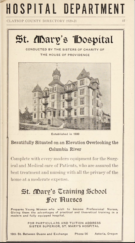
Across the street, is the site of our third stop, the four story St. Mary’s Hospital. St. Mary’s was built in 1905 and was owned by the Sisters of Charity of Providence. Between 1909 and 1948, the hospital ran a nurse training program and in that span, 245 women became Registered Nurses. The program was run by the Sisters each donning identical black habits and silver crosses, and wore white tunics when serving their patients. Even though the ornate wooden hospital survived the fire, you won’t see the actual 1905 wooden building today because it was razed in 1975. What you can see is its 1931 west wing addition, which is now The Owens-Adair Apartments at 15th and Exchange Streets. Continue forward on Duane, then make a right turn at 16th.
|
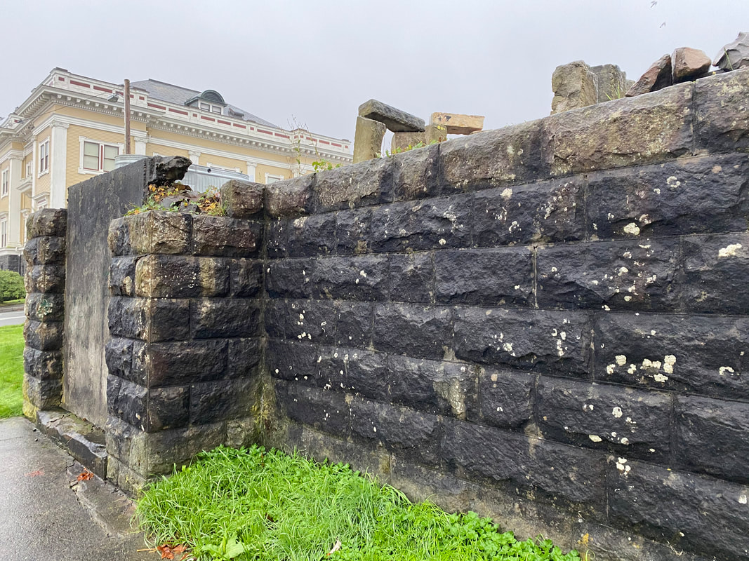
Notice on your right hand side, the stone wall rising up from the side walk. This was the original foundation of the hospital. In pictures, you would see that this wall surrounded the first floor which led to the stairs up to the front columned entrance. As the fire began to creep toward the hospital, volunteers, including several high school boys began carrying the 100 or so patients out of the hospital on stretchers and transported them in ambulances to the high school up on Jerome where they were safe from the fire. Meanwhile, tireless citizens threw water at the flames from the roof of the hospital with enough success to keep it from destruction. This effort protected the adjacent building from burning down as well. Across 16th St., you’ll see the large official looking white and yellow building which, in 1922, served as Astoria’s City Hall. Built in 1904-05, City Hall was where the police station was located complete with a jail in the basement. Today, this building serves as the Clatsop County Historical Society Heritage Museum where you can learn more about the building, itself, and Astoria’s rich history.
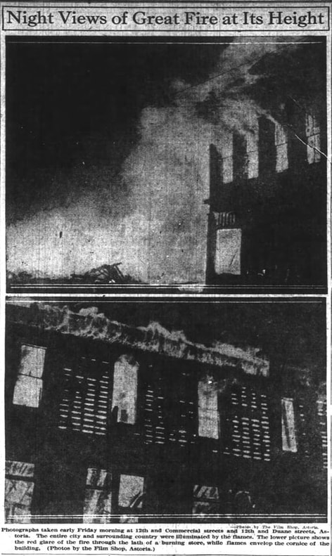
This image was published in the Saturday, December 9, 1922 The Morning Oregonian newspaper.
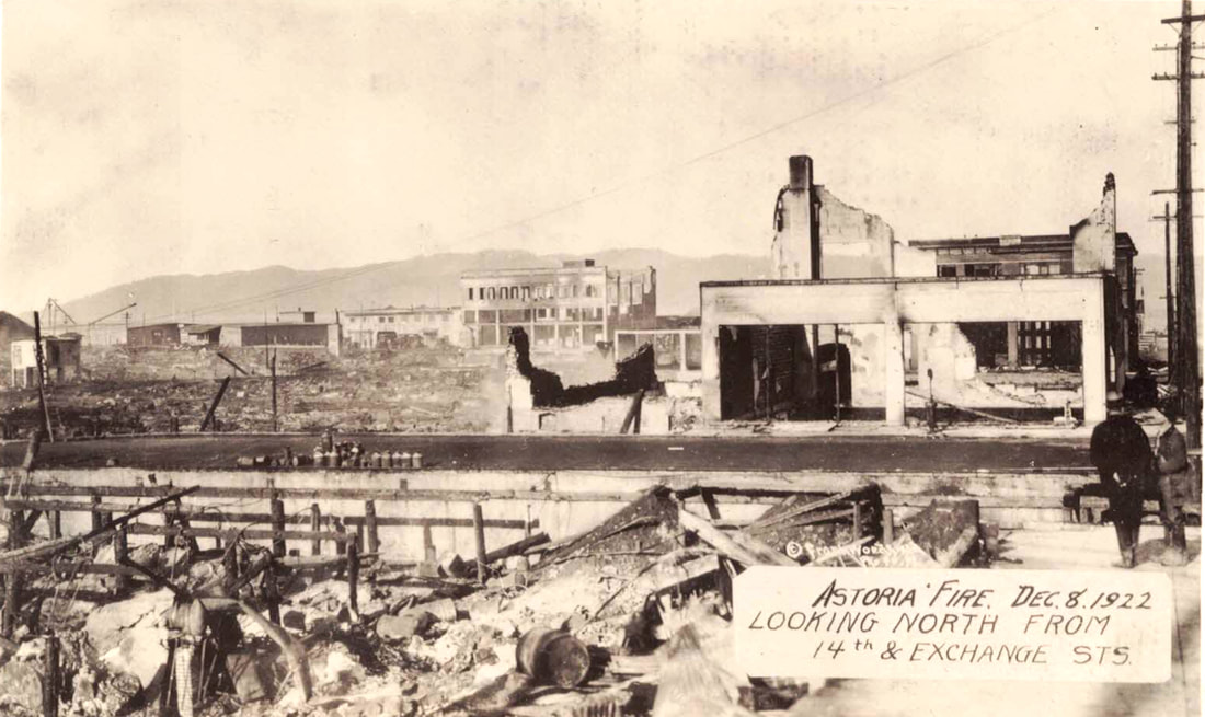
In the blocks north of here, the fire spread east about as far as 17th street caving in the pavement on Commercial St. from 9th to 17th, where the fire coincidentally burned down the city’s fire department headquarters which was located at Commercial and 17th streets. If you look at the map you’ll see the fire path along the Astoria Riverwalk. In 1922, many years before the riverwalk existed, the edge of town, which was the river front district, officially ended at the Columbia River pierhead line. On the tracks where our trolley runs today, was where travelers could take the Astoria and Columbia River Railroad train to either Portland or Seaside. After crossing the railroad tracks at the edge of downtown you would have seen several docks and warehouses, including the O.W.R. & N. (Oregon-Washington Railroad & Navigation Company) Dock at the foot of 17th, which you can see on the map above. In addition to the fire station at 17th St., the wooden train depot station was also lost that night to the fire. Along the river front, the many docks and warehouses that lined the pierhead were protected by high pressure water lines from the Stutz pumper (which can be seen today at the Uppertown Firefighters Museum at 2968 Marine Dr.), two fire engines that were placed on barges pumping water from the river into several hoses, and help from the U.S.S. Manzanita. The photo below was taken at 14th and Exchange. Looking through the rubble, you can see the Young building the the background on the right side of the photo.
In the blocks north of here, the fire spread east about as far as 17th street caving in the pavement on Commercial St. from 9th to 17th, where the fire coincidentally burned down the city’s fire department headquarters which was located at Commercial and 17th streets. If you look at the map you’ll see the fire path along the Astoria Riverwalk. In 1922, many years before the riverwalk existed, the edge of town, which was the river front district, officially ended at the Columbia River pierhead line. On the tracks where our trolley runs today, was where travelers could take the Astoria and Columbia River Railroad train to either Portland or Seaside. After crossing the railroad tracks at the edge of downtown you would have seen several docks and warehouses, including the O.W.R. & N. (Oregon-Washington Railroad & Navigation Company) Dock at the foot of 17th, which you can see on the map above. In addition to the fire station at 17th St., the wooden train depot station was also lost that night to the fire. Along the river front, the many docks and warehouses that lined the pierhead were protected by high pressure water lines from the Stutz pumper (which can be seen today at the Uppertown Firefighters Museum at 2968 Marine Dr.), two fire engines that were placed on barges pumping water from the river into several hoses, and help from the U.S.S. Manzanita. The photo below was taken at 14th and Exchange. Looking through the rubble, you can see the Young building the the background on the right side of the photo.
|
Take a right on Exchange at 14th St., and we’ll get back onto the fire path. Notice on the map, that Exchange makes a little curve. Follow this curve on the south side of the street and then stop at 12th St. for our 4th site. On the corner of Exchange and 12th streets is the building that was once Astoria’s YMCA. |
|
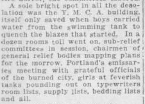
“A sole bright spot in all the desolation was the Y.M.C.A building, itself only saved when boys carried water from the swimming tank to quench the blazes that started…” Sunday Oregonian, December 10, 1922. Because it was saved from completely burning down, the YMCA was able to become headquarters for the General Relief Committee after the fire, even though it was heavily damaged. Here, food and shelter was provided the next morning to those who lost their homes to the fire.
|
“…In a dozen rooms toil went on, sub-relief committees in session, chairmen of general relief bodies mapping plans for the morrow. Portland’s emissaries meeting with grateful officials of the burned city, girls at feverish tasks pounding out on typewriters room lists, supply lists, bedding lists, and all.”
Sunday Oregonian, December 10, 1922.
The gym was filled with a hundred army cots for tired fire fighters and other workers, many whose homes were now gone. The basement served sandwiches and hot coffee throughout the night. Other space in the YMCA was separated out and converted into temporary office space for local businesses including the Astoria newspaper, The Evening Budget, who, like the Morning Astorian, continued reporting the news even the day after the fire.
|
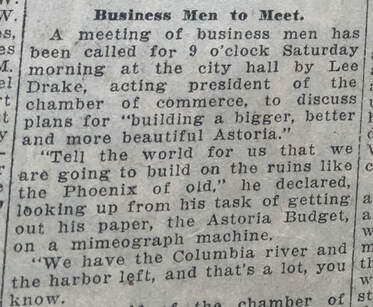
“A meeting of business men has been called for 9 o’clock Saturday morning at the city hall by Lee Drake, acting president of the chamber of commerce, to discuss plans for ‘building a bigger, better and more beautiful Astoria.’ ‘Tell the world for us that we are going to build on the ruins like the Phoenix of old,’ he declared looking up from his task of getting out his paper, the Astoria Budget, on a mimeograph machine. ‘We have the Columbia river and the harbor left, and that’s a lot, you know.’" The Morning Oregonian, Saturday, December 9, 1922 |
“Let every citizen unite with the common purpose to advance, to grow again; let none lag; let none be dismayed. Every Astorian should echo the cry of those, who called upon to do the impossible and dare the utmost on an embattled front in foreign land, made their slogan of two simple words: ‘Let’s Go.’”
John S. Dellinger, editor, Morning Astorian December 9, 1922
John S. Dellinger, editor, Morning Astorian December 9, 1922
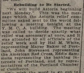
“‘We will build Astoria beginning next Monday.’ This was the message which the Astoria Relief committee asked sent to the world following a meeting tonight at the Y.M.C.A building.”
The Morning Oregonian, Saturday, December 9, 1922
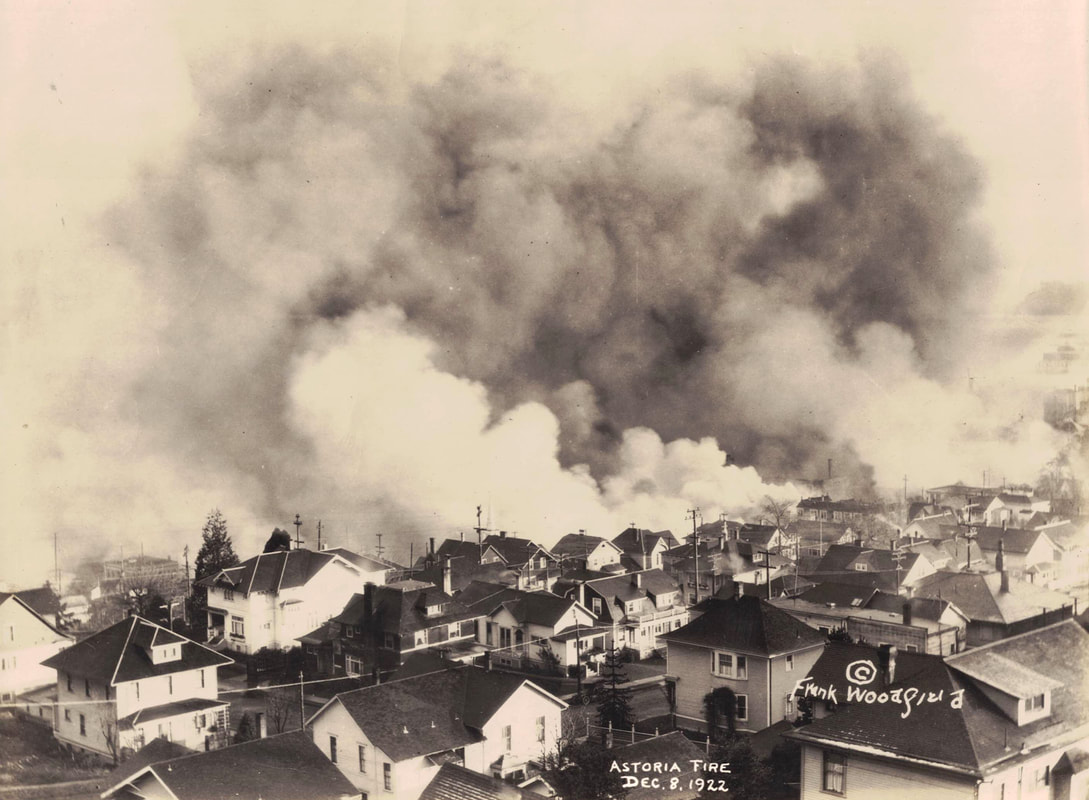
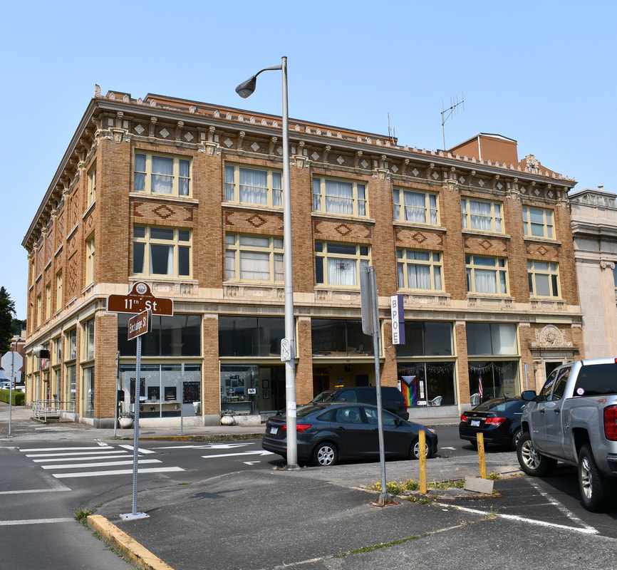
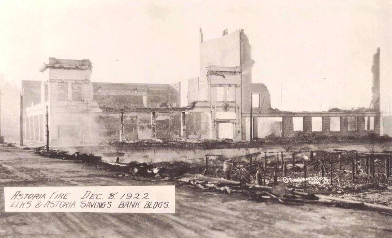
At 12th St. go ahead and cross Exchange St. and continue walking along Exchange toward 11th St. This photo was taken from the neighborhoods south of the fire. You can see downtown is totally engulfed by clouds of smoke. On 11th, you’ll see the B.P.O.E Elks Temple Lodge. This particular building was constructed in 1924 on the site of the original Elks Lodge that burned down in the fire.
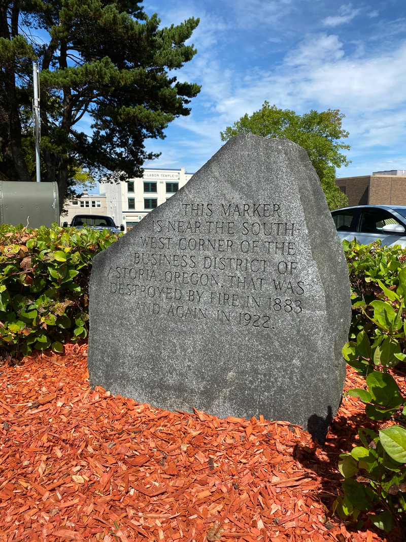
Stop when you reach 9th St. According to the map, this is the corner of the fire reach path, our fifth stop. Notice on your right there is a granite monument marking the edge of the business district that was destroyed. Take a moment and look northeast and just imagine how a hundred years ago, everything just disappeared over night. Five million gallons of water was used during the eleven and a half hours of burn time. The estimated financial loss tallied up to over ten million dollars. The fact that this was where houses and buildings were no longer built on pilings and instead were built on solid ground suggests that the fire no longer had a strong means to spread and at that point could be controlled. Many houses on the streets surrounding this location have been standing since the mid to late 1800s, including the Flavel House which was constructed in 1885.
As we continue on Exchange, turn right onto 8th St. You will see the Flavel House on your left. When you reach Commercial St., look west. You will notice that the 1904 Clatsop County Courthouse building, which sits between 8th and 9th Streets on Commercial St. survived the fire. The post office you see now (across Commercial from the courthouse) sits on the site of the previous post office which also survived the fire, but was eventually replaced in 1933 with the present day building.
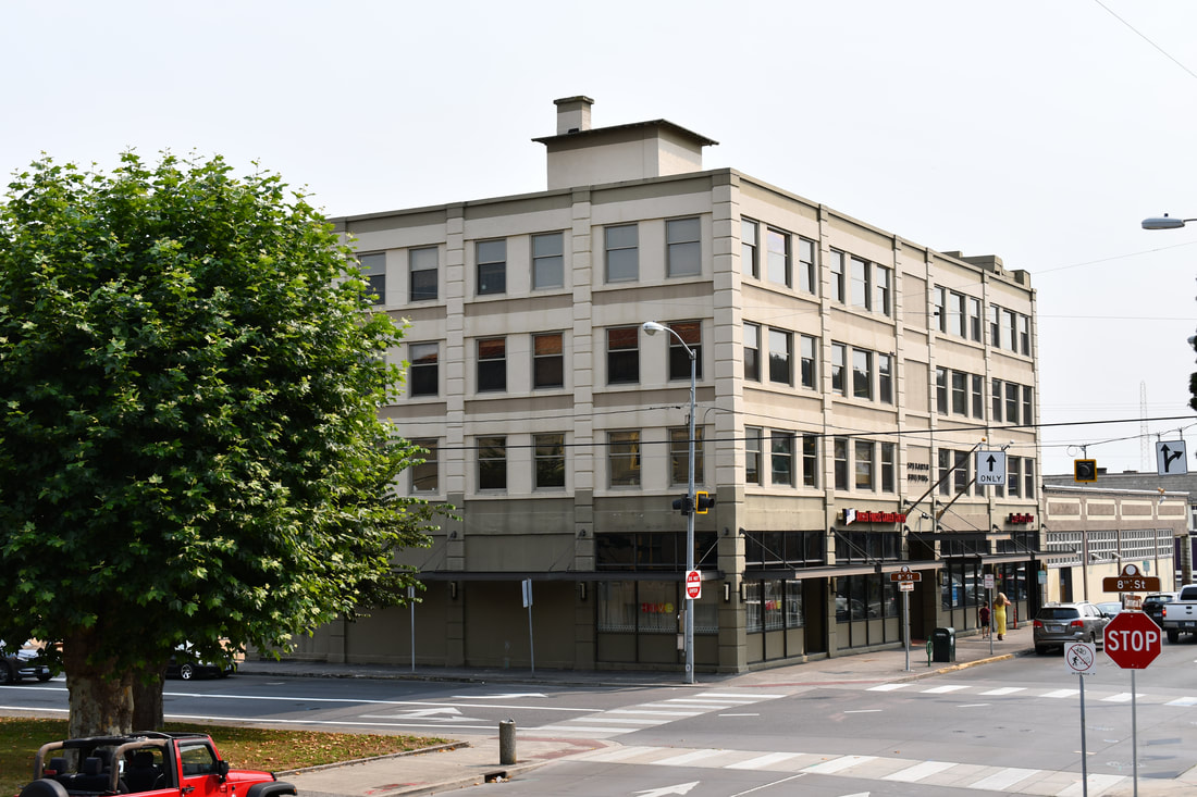
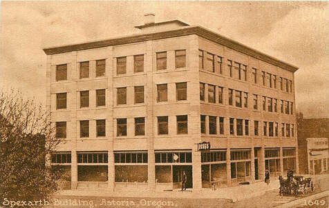
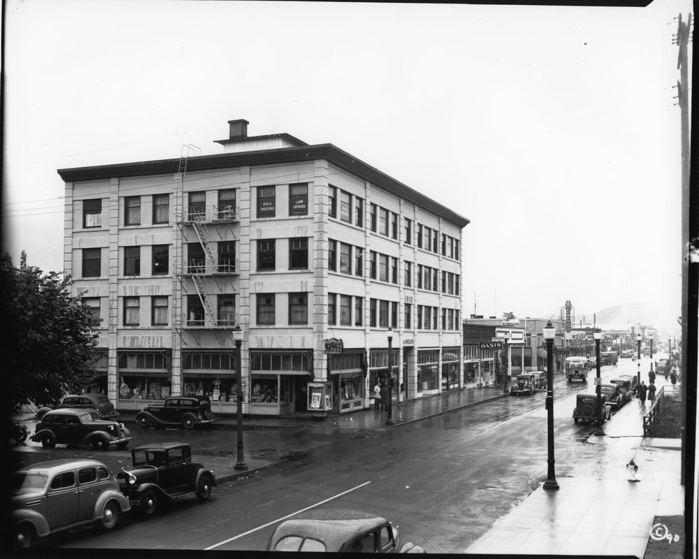
At the corner of 8th and Commercial you will see the second downtown business district building that, like the Young Building, did not burn down. This is the Spexarth building which was built in 1910 out of reinforced concrete, thus protecting it from destruction. This four story building acted as a sort of fire wall and the only building of such construction in the area. Though, due to its windows shattering from the heavy booms of dynamite, the interior of the Spexarth was still badly damaged.
“The flames were by now licking on the Spexarth building with cement roof, cement floors, and cement stair-case. It seems as though this building was surely fire-proof. It is to all intents. The over-lapping cornice of the roof and the wooden window shutters were lined with tin or sheet iron. This simply melted and the window frames and cornice started to burn as a consequence. Fortunately the buildings next to this were of low construction and some were razed with dynamite and others torn down. The Spexarth building after a severe scorching was saved.”
August Hidebrand, Memories of Astoria’s Great Fire, December 8, 1922, CUMTUX 2011 Vol 31 No. 2 Spring.
August Hidebrand, Memories of Astoria’s Great Fire, December 8, 1922, CUMTUX 2011 Vol 31 No. 2 Spring.
The photo above was taken during the rebuild. The intersection in the forefront is Commercial and 12th Streets. The Spexarth Building sits toward the back on the left side. It is the light colored building with the six visible windows.
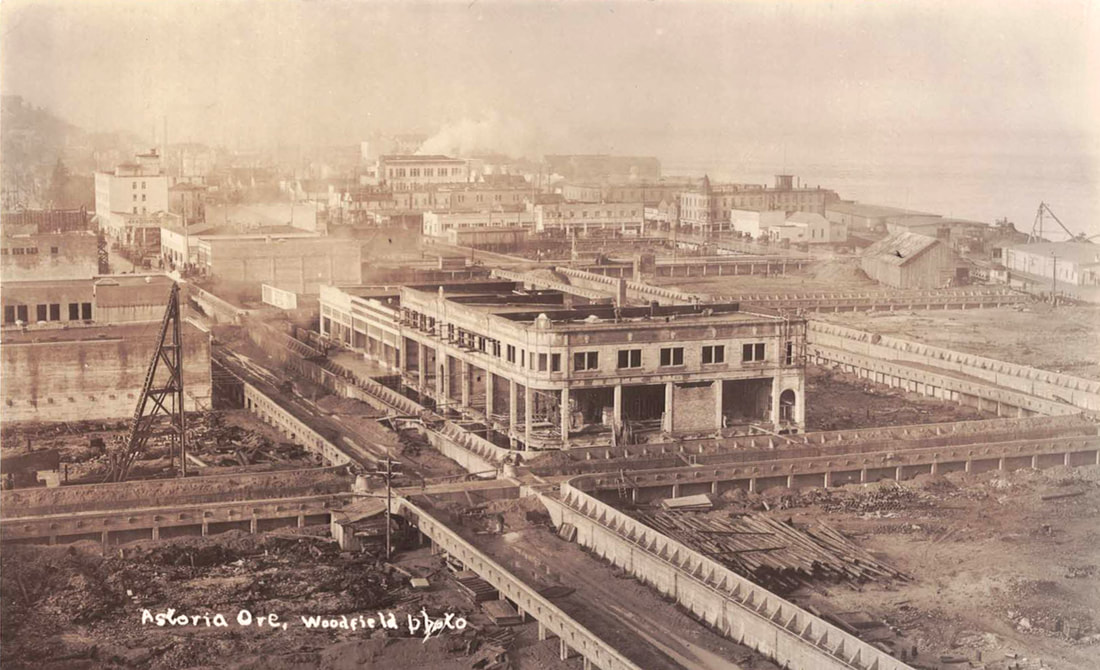
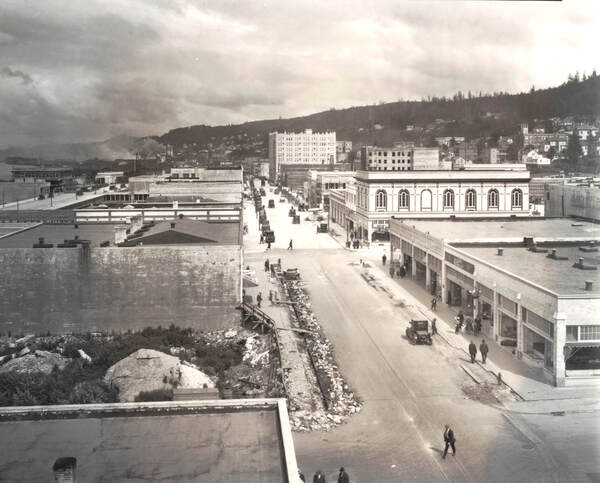
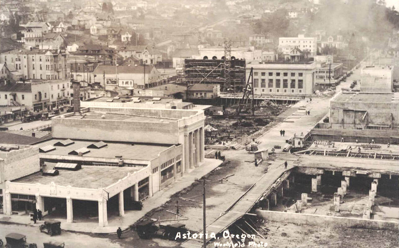
Let’s talk about the streets, themselves, again. You saw that at on Commercial and 14th Streets, the Young Building was modified to accommodate the widening of the streets during the rebuild. Here, that case was different. No such modifications were made to the Spexarth which meant that Commercial St. was not widened until after 9th. If you look east down Commercial, you’ll notice a shift in the street grid. The sidewalks here don’t line up with the sidewalks on the next block. This block demonstrates the original width of all of Commercial before the fire. In these photographs, you can see the before and after construction of the sidewalks that were installed during the rebuild after the streets were widened. The photos below show the process of widening Commercial St. at 9th. The photo on the left is the before and the after is on the right. Notice the Odd Fellows building in the middle right and John Jacob Astor Hotel in the background.
Let’s talk about the streets, themselves, again. You saw that at on Commercial and 14th Streets, the Young Building was modified to accommodate the widening of the streets during the rebuild. Here, that case was different. No such modifications were made to the Spexarth which meant that Commercial St. was not widened until after 9th. If you look east down Commercial, you’ll notice a shift in the street grid. The sidewalks here don’t line up with the sidewalks on the next block. This block demonstrates the original width of all of Commercial before the fire. In these photographs, you can see the before and after construction of the sidewalks that were installed during the rebuild after the streets were widened. The photos below show the process of widening Commercial St. at 9th. The photo on the left is the before and the after is on the right. Notice the Odd Fellows building in the middle right and John Jacob Astor Hotel in the background.
Astoria learned a big lesson in 1922. This wasn’t even the first time a significant portion of downtown was destroyed by a fire. In 1883, much of Commercial St. was destroyed in the Clatsop Mill fire. Things had to change. Astoria could not afford to be rebuilt as another fire trap. For example, buildings were constructed with brick and mortar instead of wood. Architecture evolved in downtown Astoria as well.
From the Register of Historic Places:
"When the commercial district was rebuilt in 1923, many building exteriors looked forward rather than to the past. Both building form and ornamentation were streamlined. Gable roofs were a thing of the past, but parapet walls stayed in favor. Bracketed eaves and dentil cornices disappeared in favor of equally heavy, but unbroken cornices supported by pilasters…Some earlier buildings used second and third story bay windows; now all facades are flat.”
"When the commercial district was rebuilt in 1923, many building exteriors looked forward rather than to the past. Both building form and ornamentation were streamlined. Gable roofs were a thing of the past, but parapet walls stayed in favor. Bracketed eaves and dentil cornices disappeared in favor of equally heavy, but unbroken cornices supported by pilasters…Some earlier buildings used second and third story bay windows; now all facades are flat.”
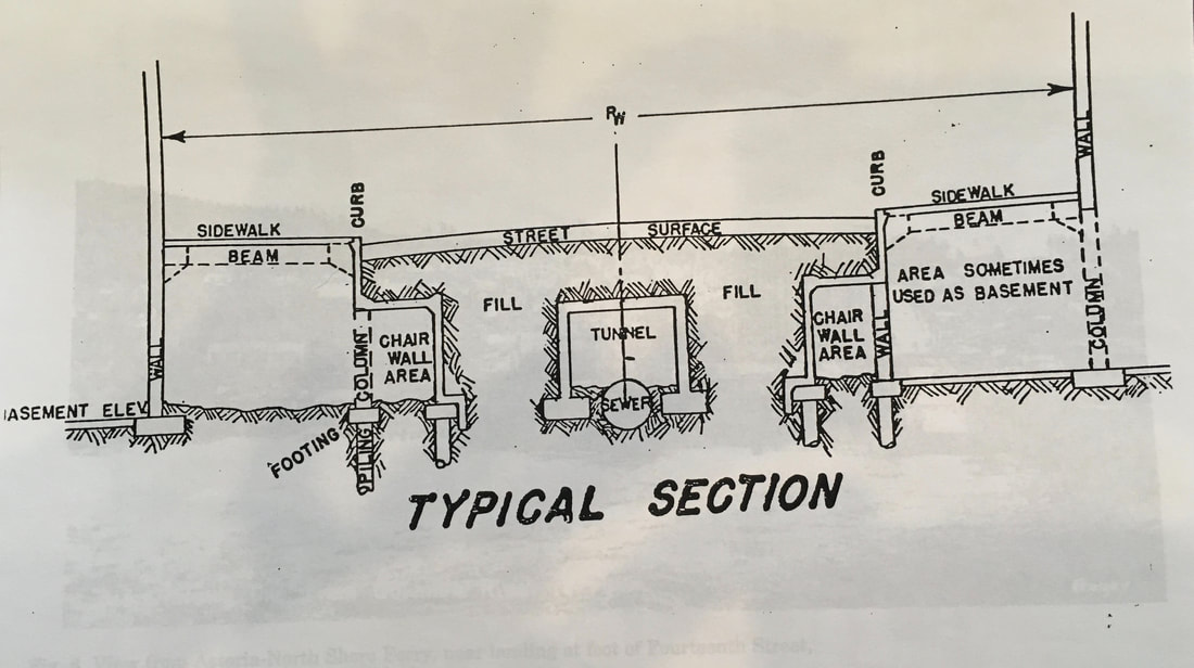
The big change, though, is that Astoria no longer sits atop pilings over the tide flats. Instead, chair-walls are used to support the buildings downtown. The way these work is that space beneath the streets was filled in with dredged river sediment and tunnels on either side are for water, utility lines, and wiring systems. Side walks are hollow beneath their surfaces and many of the businesses have basements. This was when the vault lights were installed. The vault lights are the grids of purple glass you see beneath your feet. They allowed light to shine into the underground area. To learn more about vault lights, check out our Restoria podcast season one which includes six episodes all about vault lights.
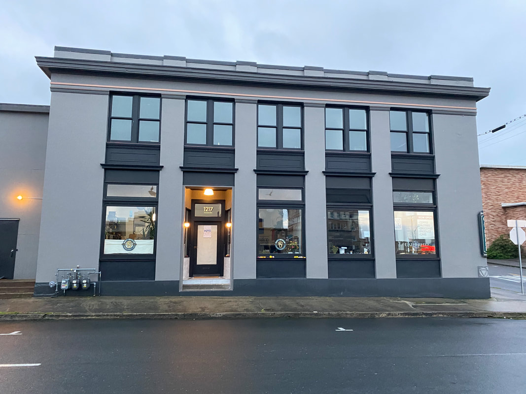
Keep walking down Commercial St., take a right on 11th then a left on Duane St. This tour ends at the Lower Columbia Preservation Society. This photo was taken before our building was re-constructed. The empty lot on the right is the south end of today's Liberty Theater. In the center of the picture, you can see the columned Bank of Astoria. Use that as a reference to figure out your position. If you have questions from your tour today or would like to learn more about historic preservation, stop in and check us out!
References for researching for this tour included Clatsop County Historical Society CUMTUX Quarterlies, historical newspapers, Sanborn maps, Polk Directories, and Downtown Historic Inventories.
Photographs were generously donated by the Clatsop County Historical Society Archives.
Photographs were generously donated by the Clatsop County Historical Society Archives.
